


Boondocking in California: Top 10 Free RV Camping Spots
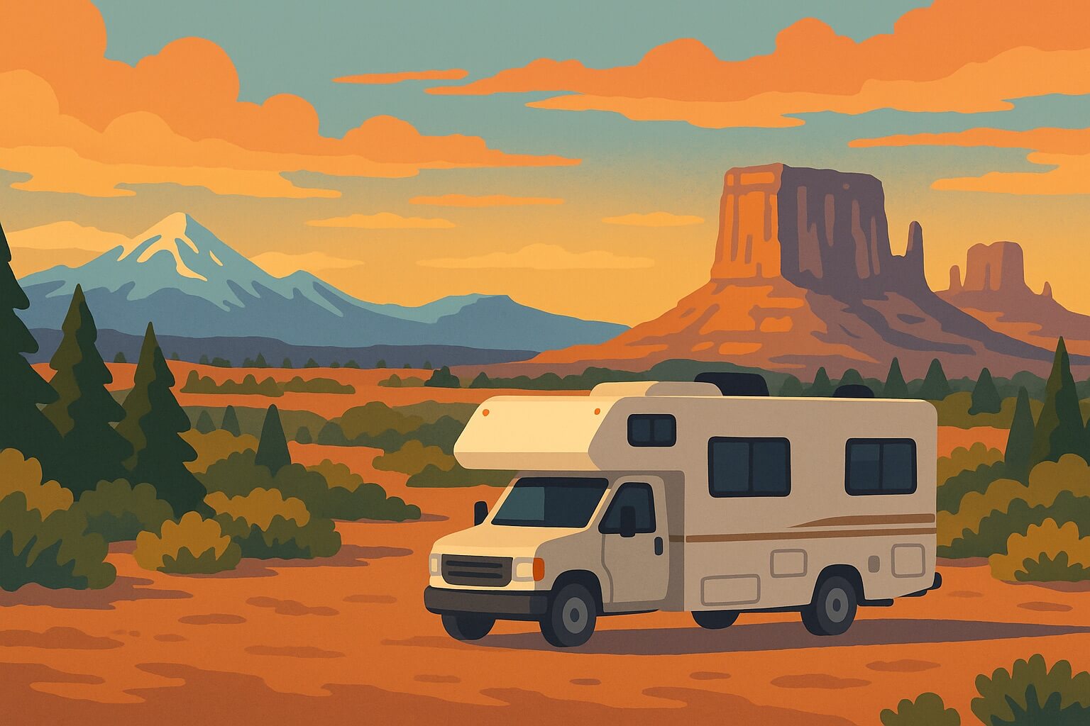
From the fog-kissed Big Sur ridges to the sun-baked Mojave flats, California packs every ecosystem an RVer could crave. Millions of acres of BLM‑managed desert, six National Forests, a handful of high‑country lakes and even one state park (Anza‑Borrego) invite free, off‑grid camping , provided you follow each agency’s stay-limit and fire-permit rules.
This guide pin-drops ten of the Golden State’s best boondocking zones—hand-picked for scenery, road access and rig-size flexibility—so you can trade RV-park crowds for wide-open horizons.
Ready to roll? Use our RV comparison engine to line up prices, sizes, and pickup points statewide—then book the rig that matches California’s towering pines or windy desert tracks in just a few clicks.
TABLE OF CONTENTS
- 1. Quick-Look Map & Rig-Fit Comparison
- 2. Is Boondocking Legal in California?
- 3. Top 10 Spots
- 3.1 Alabama Hills Recreation Area
- 3.2 BLM Land South of Joshua Tree National Park
- 3.3 Anza-Borrego Desert State Park
- 3.4 Inyo National Forest — Owens River Road
- 3.5 Los Padres National Forest — Prewitt Ridge
- 3.6 Shasta-Trinity National Forest — Gregory Beach Dispersed Area
- 3.7 El Dorado National Forest — Mormon Emigrant Trail
- 3.8 Modoc National Forest — Ash Creek Campground
- 3.9 Klamath National Forest — Beaver Creek Area
- 3.10 Mendocino National Forest — Lake Pillsbury Area
- 4. California Boondocking FAQs
- 4.1 Is it legal to camp for free on public land in California?
- 4.2 How long can I stay in one spot?
- 4.3 Do I need a permit for campfires or even my stove?
- 4.4 Can I dump gray or black tanks on public land?
- 4.5 What’s the rule about camping near water?
- 4.6 Is cell coverage reliable at these spots?
- 4.7 When are campfire bans most common?
1. Quick-Look Map & Rig-Fit Comparison
Tap the interactive map to see exactly where each site sits. The table below shows the landscape you’ll roll into and the biggest rig that fits without drama.
| Name | Region | Environment | RV Size |
|---|---|---|---|
| Alabama Hills Rec. Area |
E. Sierra | Desert boulders | All sizes (site‑dep.) |
| BLM S. of Joshua Tree |
S. Desert | Scrub flats | All sizes |
| Anza‑Borrego State Park |
S. Desert | Canyon basin | All sizes (road‑dep.) |
| Owens River Road Area |
E. Sierra | Alpine forest | All sizes |
| Prewitt Ridge (Los Padres) |
C. Coast | Coastal ridge | < 25 ft hi‑clearance |
| Gregory Beach (Shasta‑Tri.) |
N. Cal | Lakeside pines | All sizes |
| Mormon Emigrant Trail (Eldorado) |
Sierra | Granite ridge | All sizes (road‑dep.) |
| Ash Creek Campground |
NE Cal | Remote pines | < 22 ft |
| Beaver Creek Area |
N. Cal | River forest | < 28 ft |
| Lake Pillsbury Area |
N. Cal | Lakeside oaks | All sizes* |
2. Is Boondocking Legal in California?
Yes—if you stay on the right public land and follow each agency’s rulebook. Dispersed camping is generally legal (and free) on Bureau of Land Management terrain and inside most National Forests, while it is illegal in cities, on private land without permission, and in nearly all California State Parks except Anza-Borrego.
2.1 BLM Dispersed Camping Rules
- 14-Day / 28-Day Rule + 25-Mile Move-Out. You can occupy a spot up to 14 days in any 28-day window, then must relocate at least 25 air miles away.
- Stay on disturbed sites & existing tracks. New vegetation disturbance and off-trail driving are prohibited; keep vehicles within ≈200 ft of an established road.
- Mind desert hazards. Never camp in dry washes—flash floods are real dangers in the Mojave and Sonoran zones.
- LTVAs for long stays. Southern-desert Long-Term Visitor Areas allow up to 7-month winter stays for a seasonal fee and basic services.
2.2 U.S. Forest Service Rules
- Variable stay limits. Most forests allow 14–16 consecutive days, but each forest sets its own move-out distance (5–10 miles) and annual caps—check the local ranger district.
- Distance buffers. Camp ≥100 ft from streams and >1 mi from developed campgrounds or trailheads; use existing clearings.
- MVUM required. Download the Motor Vehicle Use Map (MVUM) to confirm which roads are legal for RV traffic; if the road isn’t on the MVUM, you can’t drive or camp there.
2.3 California State Trust Land
- Permit needed. A $15 annual Recreational Permit is mandatory and limits you to 14 total days statewide.
2.4 The Mandatory Campfire Permit
- Free, universal, and online. You must hold a California Campfire Permit for any open flame—including propane stoves and lanterns.
- Permit ≠ permission. The permit only affirms you know the rules; local Stage I or Stage II bans can still prohibit all flames. Always verify current restrictions before striking a match.
2.5 Leave No Trace & Waste Laws
- Pack out every scrap—dumping gray or black tanks on public land is illegal and can result in hefty fines.
- Maintain a 200 ft buffer from waterways when selecting a site, protecting riparian zones and wildlife corridors.
Bottom line: stay within published limits, secure a free campfire permit, and always double-check fire and road conditions before rolling out.
3. Top 10 Spots
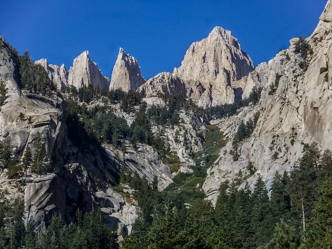
3.1 Alabama Hills Recreation Area (BLM — Bishop Field Office)
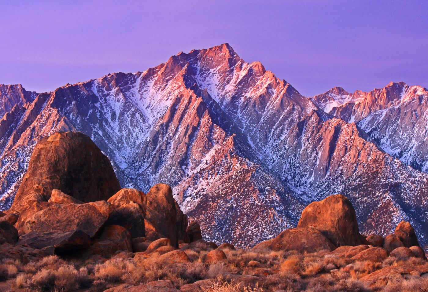
One look at these bulbous granite outcrops and you understand why Hollywood’s classic Westerns were filmed here. Park your rig in a boulder-lined pocket, step outside, and the east face of Mount Whitney dominates the horizon. Dawn washes the rocks in pink alpenglow; after dark, a Bortle-2 sky reveals shooting stars arcing over the Sierra crest. The BLM now limits camping to numbered gravel pads, but they’re tucked away so well you can still feel alone in this natural amphitheater.
- Land / Zone: Bureau of Land Management — Bishop FO
- Access: US-395 → Whitney Portal Rd → Movie Flat Rd (graded dirt, 2WD OK if dry)
- Elevation: 4 500 ft — hot days, cool nights; watch for sudden wind gusts
- Camping style: Designated gravel pads only; free permit required, first-come first-served
- Fires: Wood fires banned; propane fire pits OK with free California Campfire Permit
- Services: Vault toilets at info kiosk & Mobius Arch trailhead; dump / water in Lone Pine
- Stay limit: 14 days in any 28-day period
- Drawbacks: Crowded spring/fall weekends, dust, strict 10 p.m. quiet hours
- Best for: All rigs ≤ 35 ft; shorter rigs get the tucked-away arch views
- GPS: Main entrance (Movie Rd × Whitney Portal Rd) 36.6033, -118.1185
- More info: Alabama Hills Recreation Area Map and Guide PDF
Photographer’s tip: Walk the 0.6-mile Mobius Arch loop at dawn for Whitney-framed shots before the tour vans arrive.
3.2 BLM Land South of Joshua Tree National Park (BLM — Palm Springs Field Office)
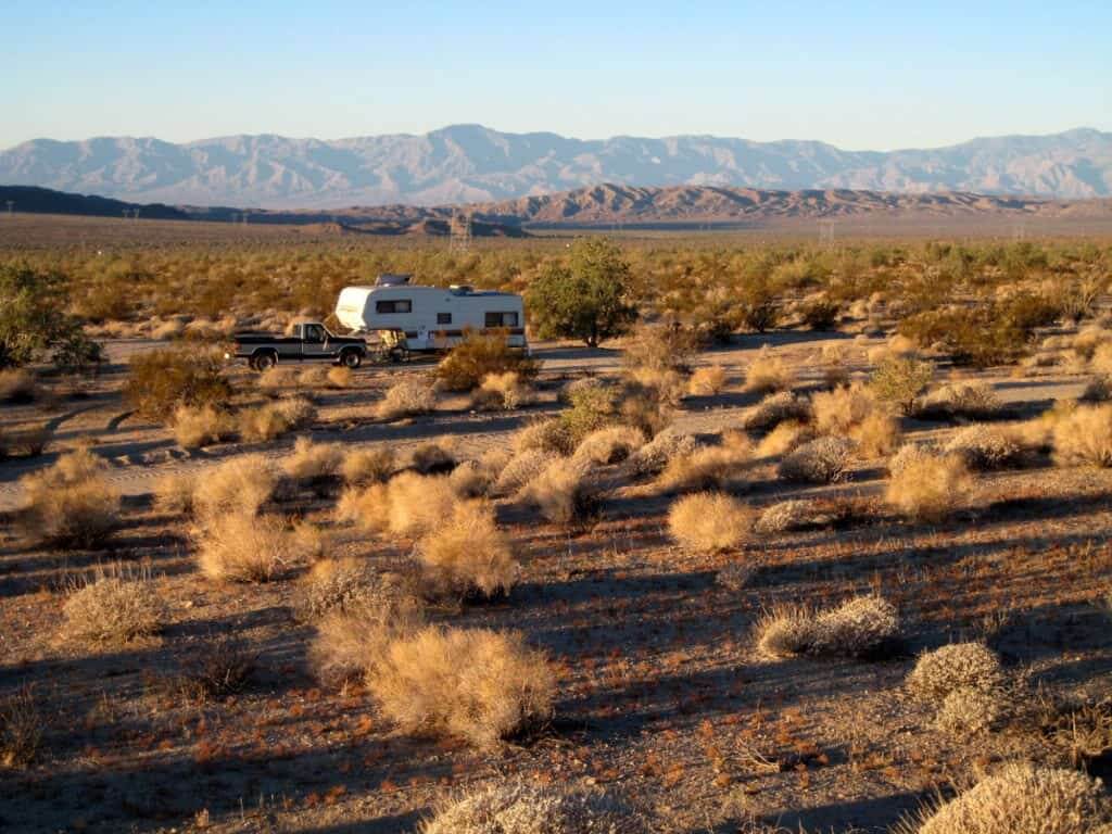
Exit I‑10 at Box Canyon Road and, within minutes, you’re rolling onto hard‑packed desert where camping outside Joshua Tree is still absolutely free. In winter the flats buzz with snowbirds soaking up 70 °F afternoons; after sunset the Chuckwalla Mountains turn lavender and the Milky Way stretches horizon to horizon. Prefer solitude? Follow side spurs into ocotillo-lined washes, listen for coyotes, and watch twilight fade without another rig in sight.
- Land / Zone: Bureau of Land Management — Palm Springs FO
- Access: I-10 Exit 168 (Box Canyon Rd) → graded dirt spurs signed “BLM Public Land”
- Elevation: 1 600 ft — ideal Oct–Mar; dangerous 105 °F+ summers
- Camping style: Expansive gravel flats; stay on existing tracks to protect soil crust
- Fires: Propane only; wood banned most of the year under South-Desert fire orders
- Services: None on-site; dump and potable water at Chiriaco Summit Travel Center (7 mi W)
- Stay limit: 14 days per 28; move ≥ 25 mi to reset
- Drawbacks: Interstate hum, occasional dust storms, no natural shade
- Best for: Any rig size—big-rig friendly
- GPS: Main access point 33.6751, -115.7819
Desert safety: Carry at least one gallon of water per person per day and monitor flash-flood forecasts during monsoon season.
3.3 Anza-Borrego Desert State Park (California State Parks)
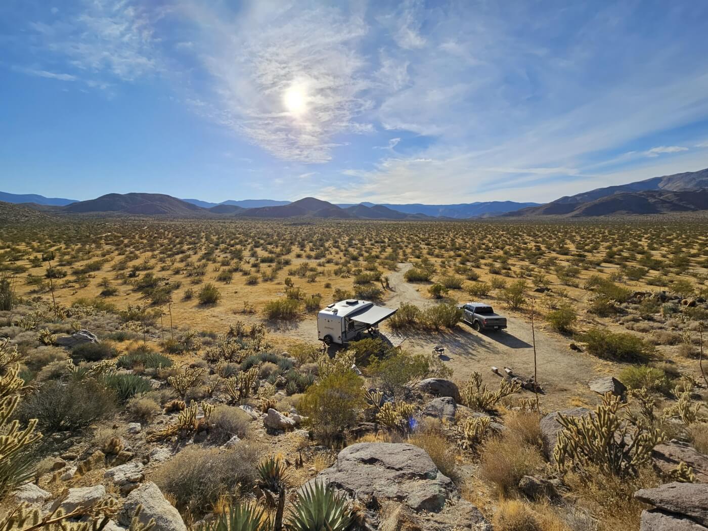
California’s largest state park welcomes genuine roadside freedom: you may camp almost anywhere along its 500‑plus miles of dirt roads. Drop into Blair Valley and you’ll find a basin ringed by burnt-ochre badlands, silent except for coyotes and the thrum of desert bees. Wildflower season (Feb–Apr) carpets the washes in lupine and desert sunflowers, while winter nights unveil International Dark Sky brilliance that rivals the high desert of Utah. Venture deeper on 4×4 tracks to discover palm oases, slot canyons and Kumeyaay pictographs that glow rust-red at sunset.
- Land / Zone: California Department of Parks & Recreation
- Access: CA-S-2 → Blair Valley turn-off (hard-packed sand/gravel; 2WD OK when dry)
- Elevation: 2 500 ft — mild winters, brutal 110 °F summers
- Camping style: True dispersed; park one vehicle length off road, leave no trace
- Fires: Propane devices only; wood fires banned park-wide
- Services: Vault toilets at Blair & Culp valleys; no water—resupply in Borrego Springs
- Stay limit: 30 nights per calendar year (max 14 nights in one spot)
- Drawbacks: Extreme heat May–Sept, aggressive water-seeking bees, patchy cell signal
- Best for: Vans & truck campers; small trailers in main valley
- GPS: Blair Valley entrance 33.0376, -116.4095
Trail tip: The 2-mile Borrego Palm Canyon trail leads to California’s largest native palm oasis—and icy pool dips in spring.
3.4 Inyo National Forest — Owens River Road (Mono Lake Ranger District)
Just north of Mammoth Lakes, Owens River Road branches off US-395 and climbs into a Jeffrey-pine high forest perfumed by vanilla-scented bark. At 7 800 ft the air is crisp even in August, and a lacework of dirt spurs leads to dozens of shaded clearings—some roomy enough for a 40-ft fifth-wheel, others perfect for a stealth van tucked beneath pumice cliffs. Anglers can cast for trout in the meandering Owens, while hot-spring hoppers soak at Wild Willy’s after a day of single-track biking.
- Land / Zone: U.S. Forest Service — Inyo National Forest
- Access: US-395 milepost 8 mi N of Mammoth Lakes → paved Owens River Rd; dirt spurs beyond
- Elevation: 7 500–9 000 ft — 70 °F days, 40 °F nights mid-summer
- Camping style: Dispersed pads off spur roads; scout tight turns for rigs > 30 ft
- Fires: Allowed in existing rings with valid Campfire Permit—Stage I/II bans common July–Sept
- Services: None; full dump, water & groceries in Mammoth Lakes (13 mi)
- Stay limit: 16 nights, then move ≥ 5 mi (forest order)
- Drawbacks: Popular June–Sept, spotty cell bars under dense canopy, solar shade loss
- Best for: All rigs; big sites near paved road, quieter nooks for ≤ 28 ft
- GPS: Popular mid-spur clearing 37.7472, -118.9475
Local tip: Arrive mid-week, snag a riverside pad, then circle back to town for a free dump station at the Mammoth Welcome Center before heading up to Devil’s Postpile.
3.5 Los Padres National Forest — Prewitt Ridge (Monterey Ranger District)
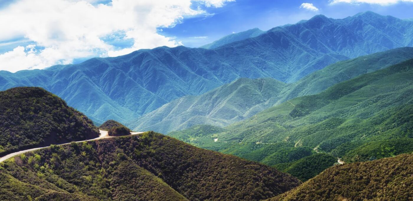
Imagine unfurling your awning above a rolling sea of clouds while the Pacific glitters 3,000 feet below—that’s the magic of Prewitt Ridge. Perched on a razor-thin spur of the Santa Lucia Mountains, the sites deliver 360-degree vistas of Big Sur’s jagged coastline by day and an ink-black, star-splashed sky at night. The reward, however, demands commitment: the final climb is a slow, wash-boarded crawl up South Coast Ridge Road where one ill-timed storm can turn switchbacks into gullies. For confident drivers in vans, truck campers or small Class Cs, the payoff is a campsite that feels like the top of the world.
- Land / Zone: U.S. Forest Service — Los Padres NF, Monterey RD
- Elevation: 3 100 ft — coastal fog below, chilly wind on the ridge
- Camping style: Dispersed clearings along ridgeline; limited space, arrive mid-week for best views
- Fires: Propane only; wood fires banned most years under high fire risk
- Services: None — no toilets, water or trash; pack it all out
- Stay limit: 14 days per district, then move ≥ 5 mi
- Drawbacks: Rough, cliff-edge road; frequent closures after storms; intense weekend crowds
- Best for: Rigs < 25 ft with high clearance
- GPS: 35.97044, -121.45158
Road-status rule: Check the Los Padres Current Conditions page the morning you roll—closures change weekly after heavy weather.
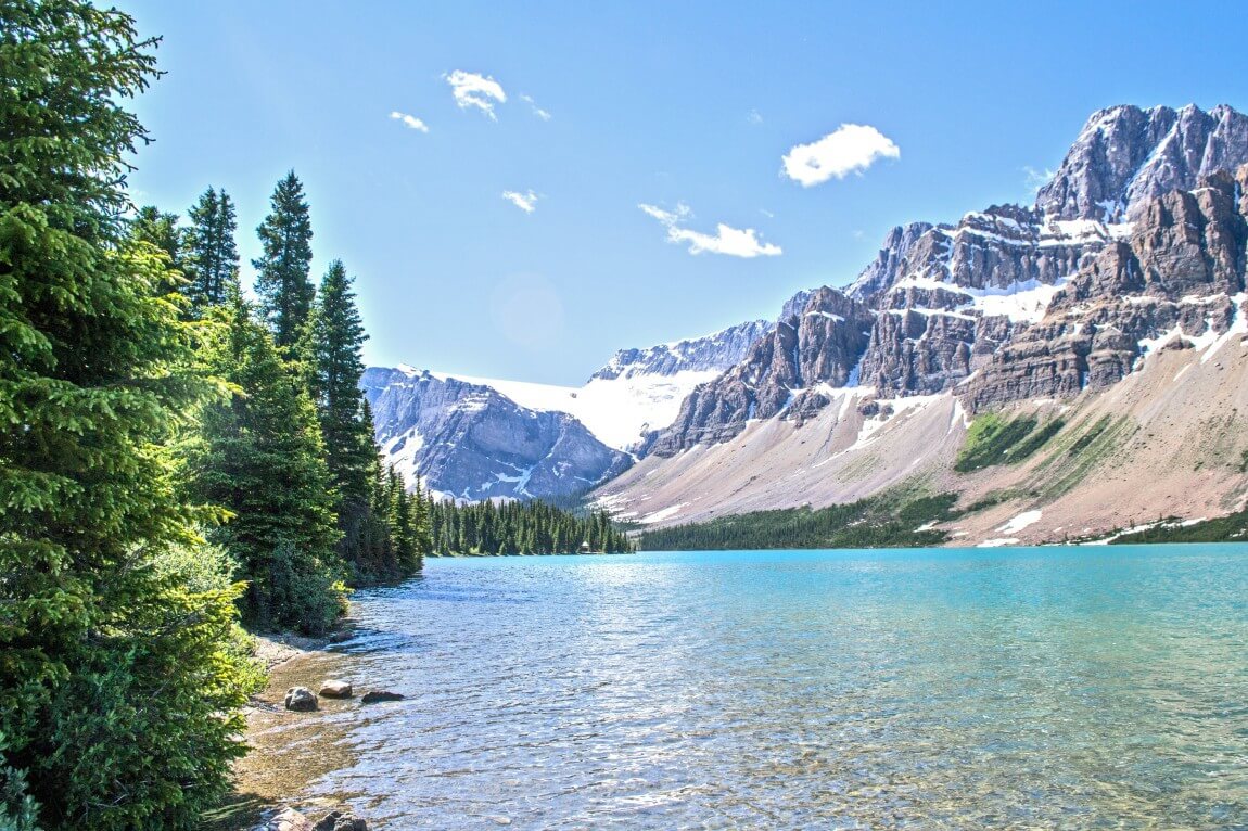
3.6 Shasta-Trinity National Forest — Gregory Beach Dispersed Area (Shasta Lake Unit)
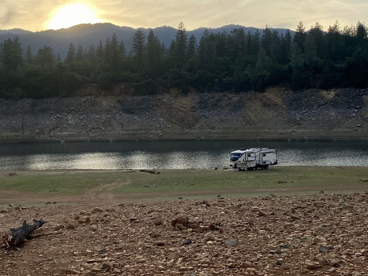
Trade desert dust for lakeside breezes at Gregory Beach, one of the few spots in California where you can back your rig right onto a Shasta Lake shoreline. Oak and pine slope gently toward the turquoise Sacramento Arm; on hot July afternoons kids launch paddleboards while anglers cast for spotted bass from camp chairs. The Forest Service treats the area as a “designated dispersed zone,” so it’s free in the off-season and lightly managed (portable toilets, trash) for a small fee in summer. Water levels dictate real estate—high water means cozy coves, low water unveils broad red-clay beaches perfect for sunset strolls.
- Land / Zone: U.S. Forest Service — Shasta-Trinity NF
- Access: I-5 Exit 702 → Salt Creek Rd → Gregory Creek Rd (paved-to-graded dirt; 2WD fine when dry)
- Elevation: 1 070 ft — summer highs 90 °F; shoulder-season sweet spot May & Sept
- Camping style: Beach or tree-line clearings; pick any previously used pad above current lake line
- Fires: Allowed in existing rings when below Stage II restrictions; bring local wood
- Services: Summer porta-toilets & dumpsters (fee season); none in winter — be self-contained
- Stay limit: 14 days, first-come first-served
- Drawbacks: Variable space with lake level, busy boat noise on holiday weekends, no cell signal
- Best for: Any rig size (firm beach flats fit 40 ft pushers)
- GPS: 40.88691, -122.36972
Lake-level hack: Check the current reservoir gauge before arrival—10 ft of drop can double your available beach.
3.7 El Dorado National Forest — Mormon Emigrant Trail (Placerville Ranger District)
Ease off Highway 50, climb to 7,200 feet, and suddenly you’re gliding across a ridge of granite domes and burn-scarred pines with the entire Crystal Range on the horizon. The paved Mormon Emigrant Trail (Forest Route 5) is a rare Sierra high-country road that dishes out effortless access to dozens of dirt spurs where you can nose a rig into utter silence. One evening you might watch alpenglow on Red Lake Peak; the next morning you’ll sip coffee while a mountain chickadee flits between black-char trunks sprouting neon-green undergrowth—visible evidence of the forest’s slow recovery from the 2021 Caldor Fire.
- Land / Zone: U.S. Forest Service — Eldorado NF, Placerville RD
- Access: CA-50 at Pollock Pines → Mormon Emigrant Trail (paved); dirt spurs branch to camps
- Elevation: 6,800–7,500 ft — 75 °F days, crisp 40 °F nights in July
- Camping style: Pull-outs and clearings off spur roads; pavement-to-dirt, easy for any length if dry
- Fires: Campfire Permit + Stage restrictions; wood often banned late June–Sept
- Services: None on site; full dump / water in Placerville (30 mi W)
- Stay limit: 14 days, then move ≥ 5 mi (forest order)
- Drawbacks: Closed by snow Nov–May, patchy post-fire scenery, some road noise near FR 5
- Best for: All rig sizes—paved access, level clearings
- GPS: 38.70368, -120.43215
Sierra hack: Arrive mid-week, fill water at Sly Park, then cruise the ridge to claim a sunset perch before the weekend crowd rolls up from Sacramento.
3.8 Modoc National Forest — Ash Creek Campground (Devil’s Garden Ranger District)
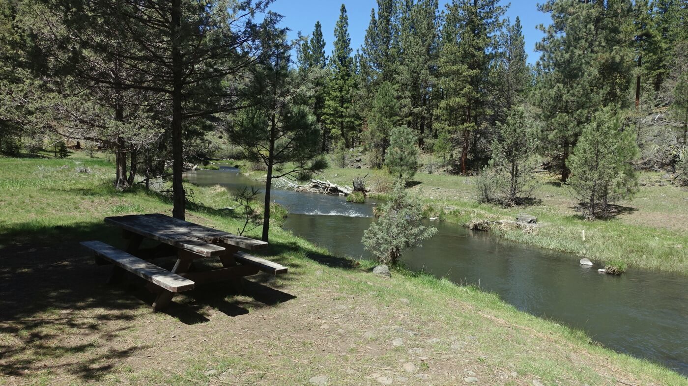
If your soul craves absolute quiet, point the GPS to California’s far-northeast corner and let two-lane blacktop fade into a single-track forest road. Ash Creek Campground—just five shaded sites tucked beside a trout-filled stream—feels less like “campground” and more like a friend’s secret fishing hole. At dawn, steam rises off the creek; by afternoon, western tanagers flash through the lodgepole canopy while you cast flies to freshly stocked rainbows. Nights are ink-black and owl-loud, and you might share the entire valley with nothing larger than a curious mule deer.
- Land / Zone: U.S. Forest Service — Modoc NF, Devil’s Garden RD
- Access: CA-299 at Adin → forest roads for 18 mi (gravel, 2 WD OK when dry)
- Elevation: 4,800 ft — spring/fall highs 70 °F; light snow possible late Oct
- Camping style: Five first-come pads with picnic tables & vault toilet (no fee)
- Fires: Existing metal rings; obey Red Flag closures
- Services: No water, no trash—pack it all out
- Stay limit: 14 days; RV max length 22 ft
- Drawbacks: Long drive from services, zero cell bars, strict length cap excludes big trailers
- Best for: Camper vans, truck campers, small C-class
- GPS: Camp loop entrance 41.16049, -120.82955
Fishing note: The California Department of Fish & Wildlife stocks Ash Creek regularly—check the hatchery schedule for a fresh-stocked weekend and bring barbless hooks.
3.9 Klamath National Forest — Beaver Creek Area (Happy Camp Ranger District)
Follow Highway 96 deep into the Siskiyou Mountains, turn toward Beaver Creek, and a hush falls over the world. A pocket-size, fee-free camp of eight sites hides beneath towering Douglas-fir and incense cedar, its picnic tables scattered along a cool, fishy stream. Daylight filters through emerald leaves, evenings bring the burble of water and the hoot of a great-horned owl, and by midnight you’ll swear no other campers exist for miles. Bring a fly rod, a good book, and zero expectations for cell service—this is a place to unplug completely.
- Land / Zone: U.S. Forest Service — Klamath NF, Happy Camp RD
- Access: CA-96 at Seiad Valley → Beaver Creek Rd 6 mi (narrow gravel; 2 WD fine when dry)
- Elevation: 1 700 ft — crisp 80 °F days, cool river nights June-Sept
- Camping style: 8 first-come pads with tables & vault toilet; no fee
- Fires: Metal rings; Campfire Permit + current restrictions
- Services: None—pack in water, pack out trash
- Stay limit: 14 days; RV max length 28 ft
- Drawbacks: Seasonal closures, zero cell bars, narrow approach for big trailers
- Best for: Rigs < 28 ft, anglers, solitude seekers
- GPS: 41.92784, -122.82913
Angler’s note: Beaver Creek holds rainbow and cutthroat trout—barbless hooks keep the population thriving.
3.10 Mendocino National Forest — Lake Pillsbury Area (Upper Lake Ranger District)
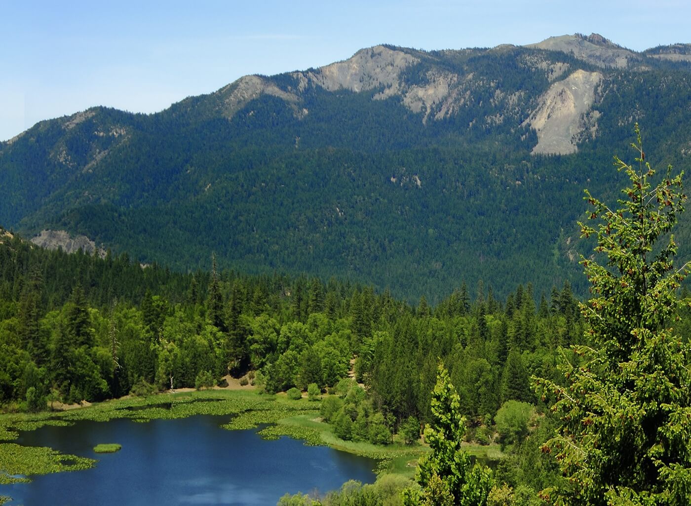
Ringed by oak and ponderosa, 2 280-acre Lake Pillsbury is a magnet for boaters, OHV riders and bald eagles alike. Inside the basin, camping is restricted to several designated sites, the most popular being Oak Flat Campground—a free, first-come loop shaded by black oaks just steps from the shoreline. Launch a kayak at dawn through mist, spend midday exploring the extensive OHV trail network, then watch sunset paint the Mayacamas Mountains copper from your camp chair. For true dispersed freedom, steer up forest roads M2 or 17N04 and pick a ridge-top clearing with distant lake views and absolute quiet.
- Land / Zone: U.S. Forest Service — Mendocino NF (campgrounds operated by PG&E)
- Access: CA-20 at Upper Lake → Elk Mountain Rd 32 mi (paved-to-graded dirt); final miles narrow & winding
- Elevation: 1 800 ft — 90 °F summers, pleasant spring & fall
- Camping style: Free designated pads in Oak Flat (vault toilet, trash); unlimited dispersed sites on surrounding forest roads
- Fires: Existing rings below Stage II; Campfire Permit required
- Services: Seasonal water & dumpsters in fee campgrounds; none in dispersed zones
- Stay limit: 14 days, first-come
- Drawbacks: Weekend OHV and boat noise, confusing mix of fee/free areas, rough access for big rigs
- Best for: Any rig in basin pads; high-clearance vans/trucks on ridge roads
- GPS: 39.44289, -122.95333
Lake hack: Water levels swing 20 ft year-to-year—check the reservoir gauge before banking on shoreline spots.
4. California Boondocking FAQs
4.1 Is it legal to camp for free on public land in California?
Yes. Dispersed camping is allowed on most BLM terrain and in every National Forest, provided you respect stay limits, fire rules and road closures. It is not allowed in most California State Parks except Anza-Borrego, or on private land without permission.
4.2 How long can I stay in one spot?
- BLM: 14 days within a 28-day window, then move at least 25 mi.
- USFS: Typically 14–16 consecutive days per Ranger District, then move ≥ 5 mi (check local orders).
- California State Trust Land: 14 total days per calendar year with a paid Recreational Permit.
4.3 Do I need a permit for campfires or even my stove?
Absolutely. A free, online California Campfire Permit is required for any open flame—including propane stoves and lanterns—on BLM and USFS lands. Local Stage I or II bans can still prohibit all flames, so check daily restrictions before lighting up.
4.4 Can I dump gray or black tanks on public land?
No. Dumping wastewater on the ground is illegal statewide and can carry heavy fines. Use Forest-Service, city, or travel-center dump stations (e.g., Lone Pine, Chiriaco Summit, Mammoth Lakes).
4.5 What’s the rule about camping near water?
Keep rigs at least 100 ft from streams or lakes in National Forests, and 200 ft on BLM lands, to protect riparian habitat. In desert regions, state law (ARS § 17-308 adopted by CA agencies) enforces a ¼-mile buffer around natural wildlife water sources.
4.6 Is cell coverage reliable at these spots?
Expect full bars near towns like Lone Pine or Borrego Springs, but zero signal in Klamath, Modoc and parts of the Sierra crest. Download offline maps (Gaia, Avenza, Google) before leaving pavement and consider a booster if you work remotely.
4.7 When are campfire bans most common?
Statewide Stage I or Stage II bans typically run June through October, peaking during late-summer heat waves and Santa Ana wind events along the coast. Always verify the current forest or BLM fire order the morning you travel.