
Canada Road Map (PDF & JPG Downloads)
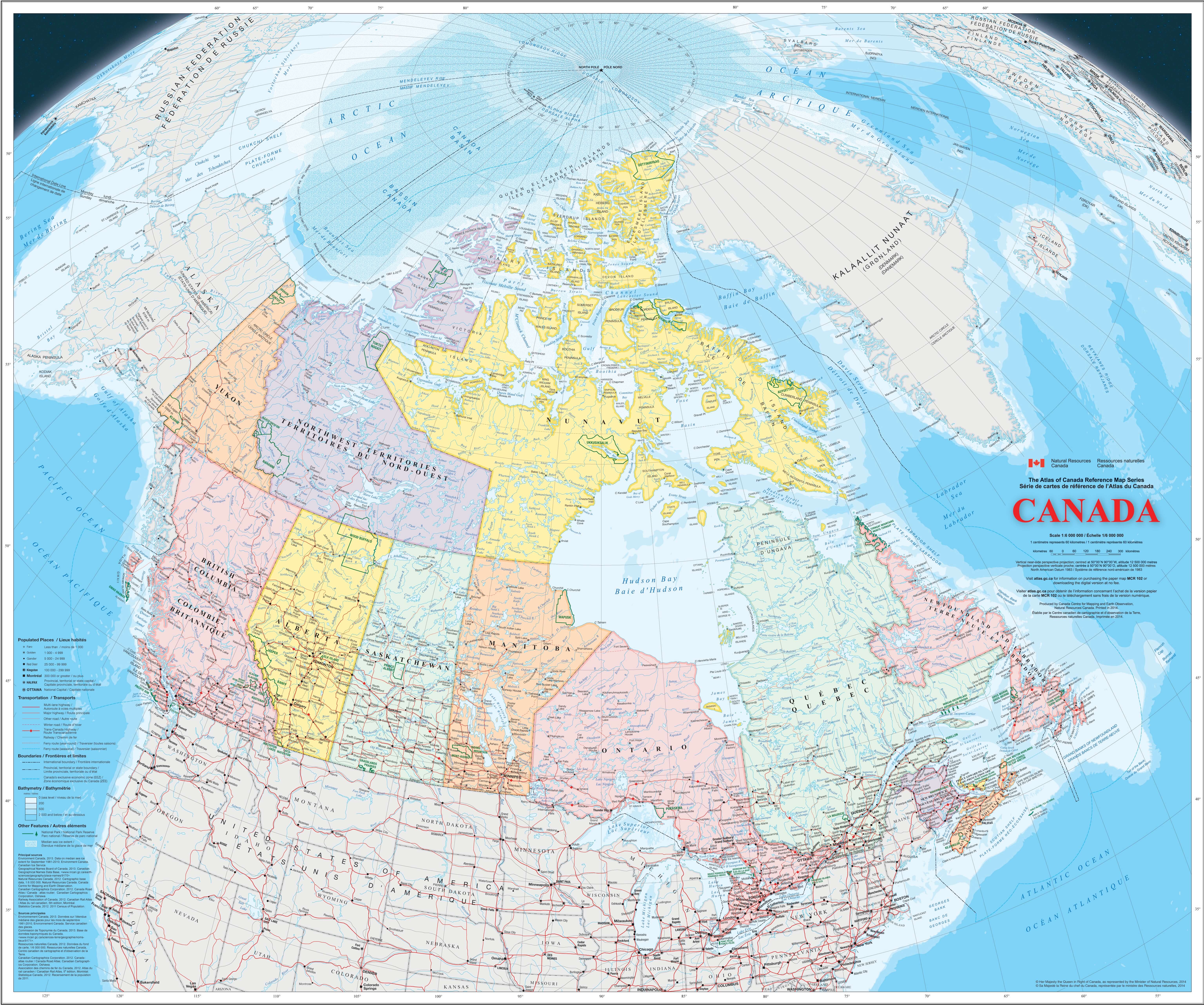
Canada makes its road geography visible at a glance on this map. You can immediately see how the network concentrates along the southern belt from British Columbia to the Atlantic, while the North opens into much larger spaces with fewer continuous links, more water barriers, and long stretches of isolated access.
Map files
- Full-size PDF (17 MB) — Open | Download
- Lighter PDF (3.7 MB) — Open | Download
- JPG image (3.7 MB) — Open | Download
What this map shows
This map presents Canada at a scale of 1:6,000,000, making the overall road structure easy to read across the entire country. The densest network follows the southern band from Vancouver through Calgary, Regina, Winnipeg, then into the Great Lakes corridor around Toronto and Ottawa, continuing along the St. Lawrence toward Montreal and Quebec City, and finally reaching the Atlantic provinces. In contrast, large northern areas across Yukon, the Northwest Territories, and Nunavut show limited continuity, with only a few long roads extending northward and vast zones without permanent connections. Major geographic references such as Hudson Bay, the Rocky Mountains, and the Labrador Peninsula help explain these breaks in the network.
The legend highlights key transport elements that shape how travel actually works in Canada. Ferry routes are essential on both coasts: they connect the mainland to Vancouver Island from the British Columbia coast and link the Atlantic provinces with Newfoundland across the Gulf of St. Lawrence. In the far North, the map also marks winter roads, temporary routes that only exist when frozen conditions allow passage between remote communities. You can also see how some regions rely on a single main corridor rather than a dense grid, particularly in northern Alberta, northern Quebec, and Labrador. This combination of strong southern highways, coastal ferry dependence, and seasonal northern access makes the Canadian road network highly uneven, with clear differences between well-connected regions and areas where reaching a destination requires planning around distance, weather, and limited routes.