
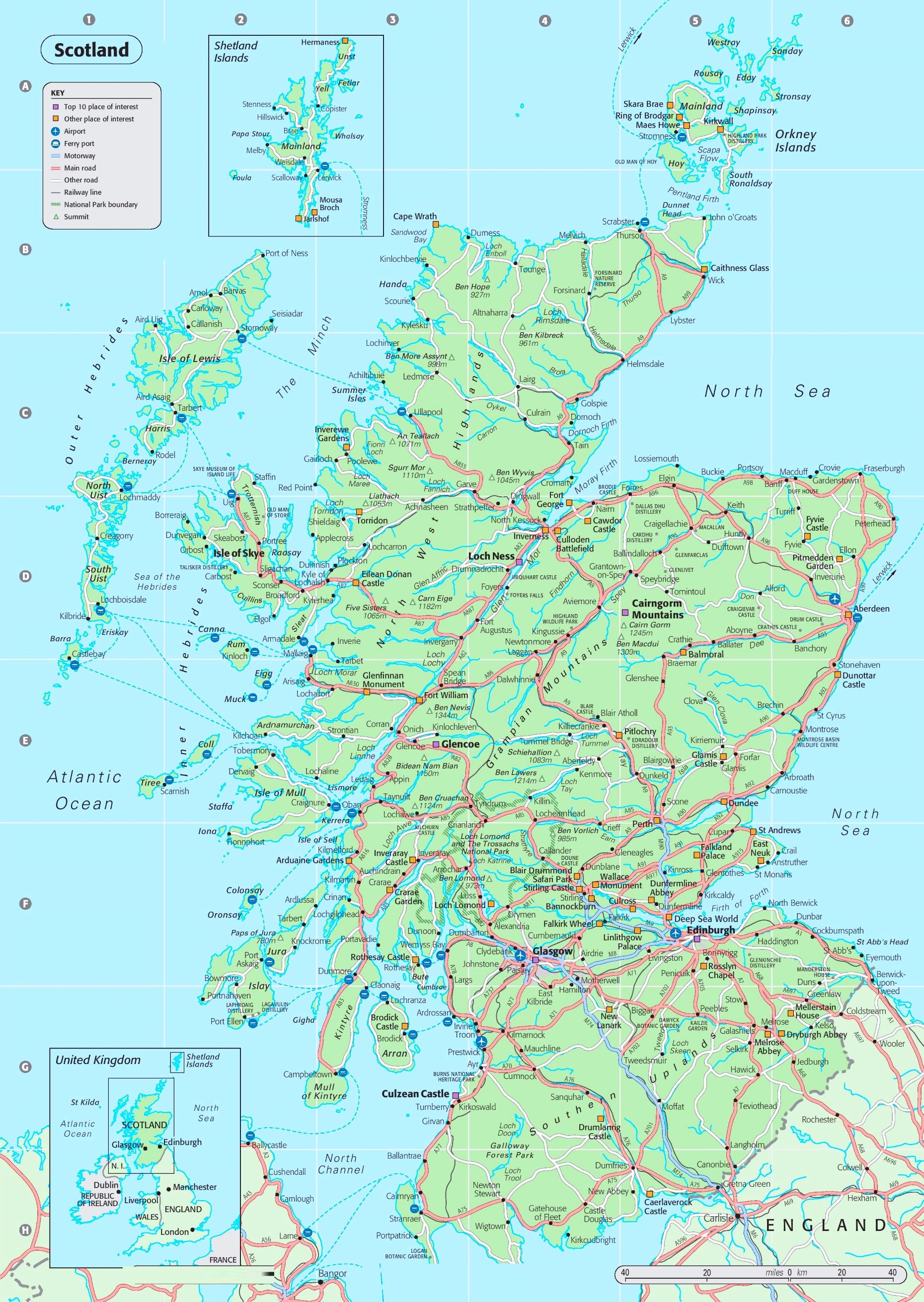
Scotland road map: view or download the PDF and JPG
Having a clear road map makes planning in Scotland much easier, especially once you start mixing cities, lochs, mountain areas and island hops. This map is useful for quick route decisions, and it’s also handy as a simple “big picture” reference alongside your phone’s sat-nav.
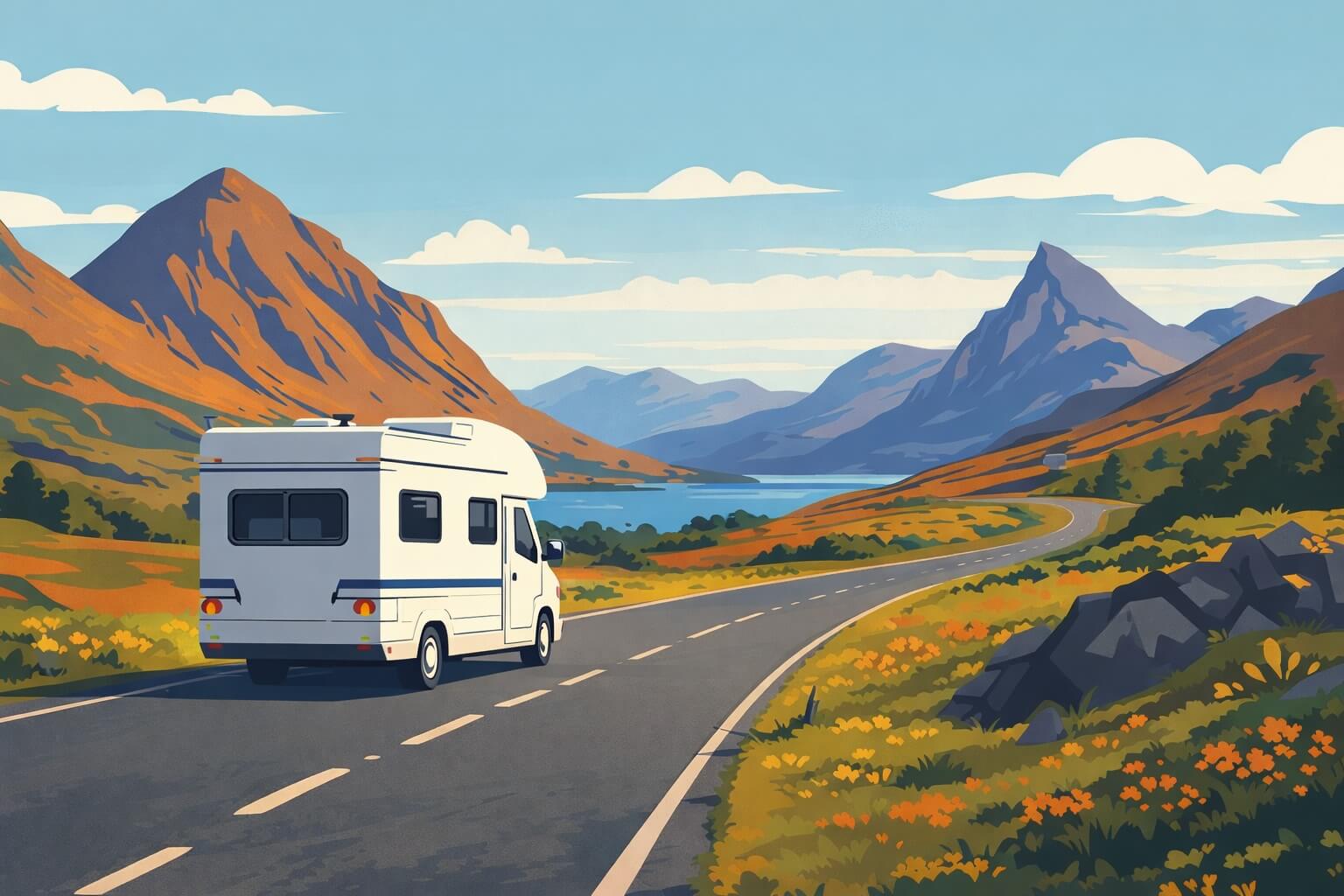
If you’re travelling by motorhome or campervan, a good overview map is even more helpful: it lets you spot the main-road corridors early, estimate realistic driving days, and plan island crossings without overloading your itinerary. If you’re comparing options, you can check motorhome and campervan hire in Scotland here: compare motorhome & campervan hire in Scotland.
Download the Scotland road map (PDF/JPG)
- Download the map (PDF) – best for printing and zooming without losing clarity.
- Download the map (JPG) – quick to save on your phone or share.
- Open the map in a new tab – useful for fast viewing while you plan.
How to read this Scotland road map (what it actually shows)
1) Road hierarchy: motorways vs main roads vs smaller routes
The legend distinguishes three road “levels”. You’ll notice that the motorway network is concentrated around the Central Belt (Glasgow–Edinburgh), while the rest of the country relies on main roads (for example, the A9 running north via Perth and Aviemore to Inverness). In the Highlands and along much of the west coast, the map shows fewer main-road corridors and more “other roads”, which is a useful clue that driving days can feel longer there than the distance suggests.
2) The main hubs and corridors on the mainland
As a planning tool, this map is very good at showing the natural “spine” routes:
- Central Belt: Glasgow and Edinburgh are tightly connected by major roads and sit close to other key stops like Stirling, Linlithgow Palace and Falkirk (shown on the map).
- North via the A9 corridor: Perth → Aviemore → Inverness is one of the clearest long-distance routes on the map, with Loch Ness just west of Inverness.
- North-east route: the road corridor towards Aberdeen is clearly marked via Dundee and the east-coast network.
- West Highlands route: the map highlights the Fort William area (with Ben Nevis nearby) and the Glencoe area, both sitting on the main west-coast approach routes.
3) Islands and ferries: how the map helps you connect the dots
Ferry ports are marked with their own symbol, and ferry routes are shown as dashed sea crossings. That means you can plan island time without guessing where the real “gateways” are. The map includes (among others):
- Outer Hebrides: key places across the Isle of Lewis and the Uists, with ferry links back to the mainland.
- Inner Hebrides: connections to islands such as Skye, Mull, Islay, Arran and others, with multiple crossing options depending on where you are on the west coast.
- Orkney Islands: shown in an inset map with places like Kirkwall and Stromness, plus the Pentland Firth crossings.
- Shetland Islands: also shown in an inset (separate from the mainland map), useful for orientation even though the travel time is not reflected by road distance.
Practical takeaway: the scale bar at the bottom is great for road distances, but ferries add “time” more than “miles”. Use the ferry lines on the map to decide which crossings are logically on your route, then plan schedules separately.
4) Airports and rail lines (for mixed transport plans)
Airports are marked with a dedicated icon, which helps if your trip starts or ends with a flight and you want to anchor your route around the nearest hub. Rail lines are also shown, mainly in the more connected parts of the country, which is useful if part of your group is meeting you by train or you’re combining driving with a rail segment.
5) National parks and mountain markers
The map outlines national park boundaries (for example, Loch Lomond & The Trossachs and the Cairngorms area are clearly labelled). It also marks mountain summits with a triangle icon and heights (you can spot Ben Nevis near Fort William, and several high points across the Cairngorm Mountains). For itinerary planning, that’s helpful in two ways: it shows where the “big scenery” clusters are, and it hints at where roads pass through more mountainous terrain.