


Ireland Road Map: Main Routes, Cities and Coastal Connections

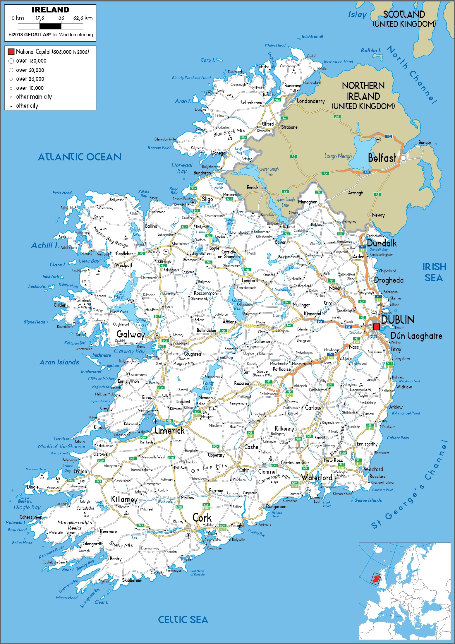
Ireland’s road network becomes much easier to understand when you see it laid out like this. From Dublin, routes extend in clear directions toward the west, the south and the border with Northern Ireland, while the rest of the country is structured around a handful of key cities such as Cork, Galway, Limerick and Sligo. This map helps you quickly grasp how journeys are organised across the island, and where routes become more indirect as the landscape opens into coastal areas and peninsulas.
Map files
What This Map Reveals About Ireland’s Roads
The map makes Ireland’s road structure easy to read at a glance. The strongest concentration appears around Dublin, where routes spread north toward Drogheda and Dundalk, west through Kinnegad, Mullingar and Athlone, and south toward Wicklow, Wexford and Waterford. Other major urban anchors such as Cork, Limerick, Galway and Sligo help organise the rest of the network, while the western side of the island shows a more broken coastal pattern around Connemara, Mayo, Kerry and Donegal.
It also shows how road continuity changes across the country. The east and south-east look denser and more direct, while areas such as Donegal, the Dingle Peninsula and the far west depend on longer, more winding links shaped by bays, mountains and peninsulas. The map also places the Republic of Ireland and Northern Ireland in one continuous frame, which makes border crossings around Dundalk, Monaghan, Cavan and Letterkenny easy to understand in practical route-planning terms.
- The Dublin–Drogheda–Dundalk axis is one of the clearest long-distance corridors on the map.
- Galway, Sligo and Donegal show how the western and north-western routes stay connected, but with less direct continuity than around Dublin.
- Cork, Killarney and Tralee illustrate how the south-west network branches into peninsulas and coastal roads.